Our products - Geosource-rtb

GeoSource-RTB (Rapid Terrain Builder) enables warfighters to rapidly create (within hours) round-earth visual / sensor databases with “to-the-horizon” rendering for training, mission rehearsal, and operational use.
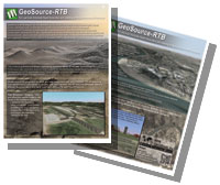
GeoSource-RTB directly imports NGA (formerly NIMA) data and / or commercial datasets to automatically build large area (whole earth, continental US, etc.) databases that include visual / sensory imagery, elevation data, 3D cultural point-features, linears and aerials.
It also allows users to update databases in near-real-time (minutes) by directly importing geo-registered imagery from a variety of sources — Unmanned Aircraft Systems, satellites, etc. GeoSource-RTB includes push / pull updating of multiple distributed simulation databases, and, through use of the easy-to-use 3D Cultural Feature Editor, enables military and civilian personnel to add, modify or delete various features by simply “dragging and dropping” features in a full 3D environment. Bomb damage assessments and Intelligence, Surveillance and Reconnaissance (ISR) resources can guide updating.
GeoSource-RTB generated terrains are fully integrated with the CYBORG Game-Engine ensuring high-performance and visual continuity with all IG features (weather, specials effects, etc.) and other ATD products (LiteFlite® Reconfigurable Simulators, ROVATTS UVS Simulators, Hero-FPS, Spectator 3D Viewer, etc.)
![]()